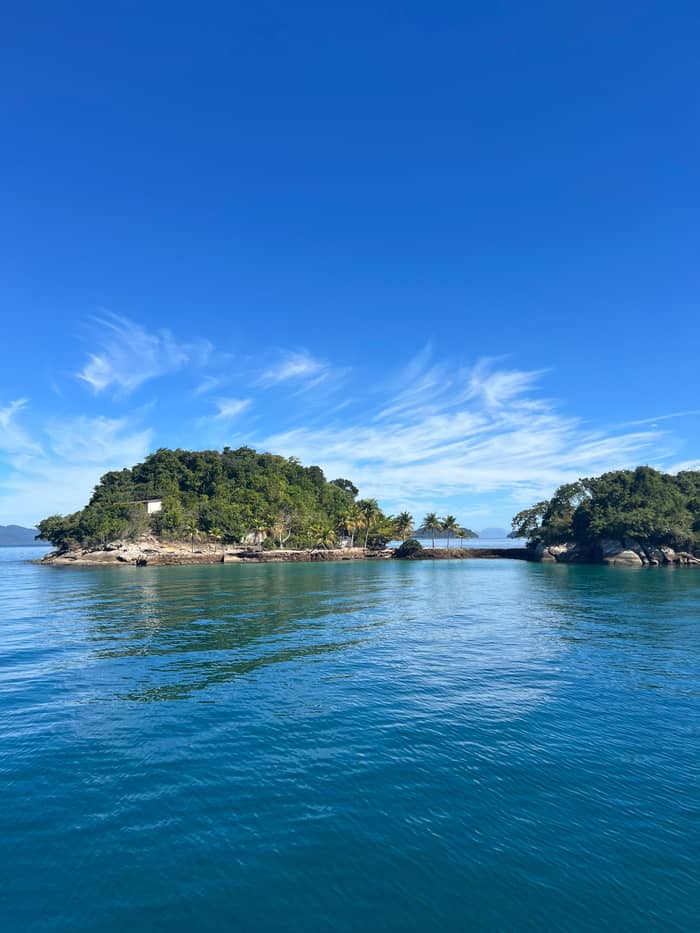
South coast
Lopes Mendes
Long sand with rough water
See the day tripLocate your stop
Summary
The beaches in Ilha Grande range from the long surf sand of Lopes Mendes to tiny Caxadaco and the capped Aventureiro, on an island in the bay off Angra dos Reis.
Island essentials
Discover 24 stops
Pick a route and tap a pin or a stop: you get its note and a Google Maps link.
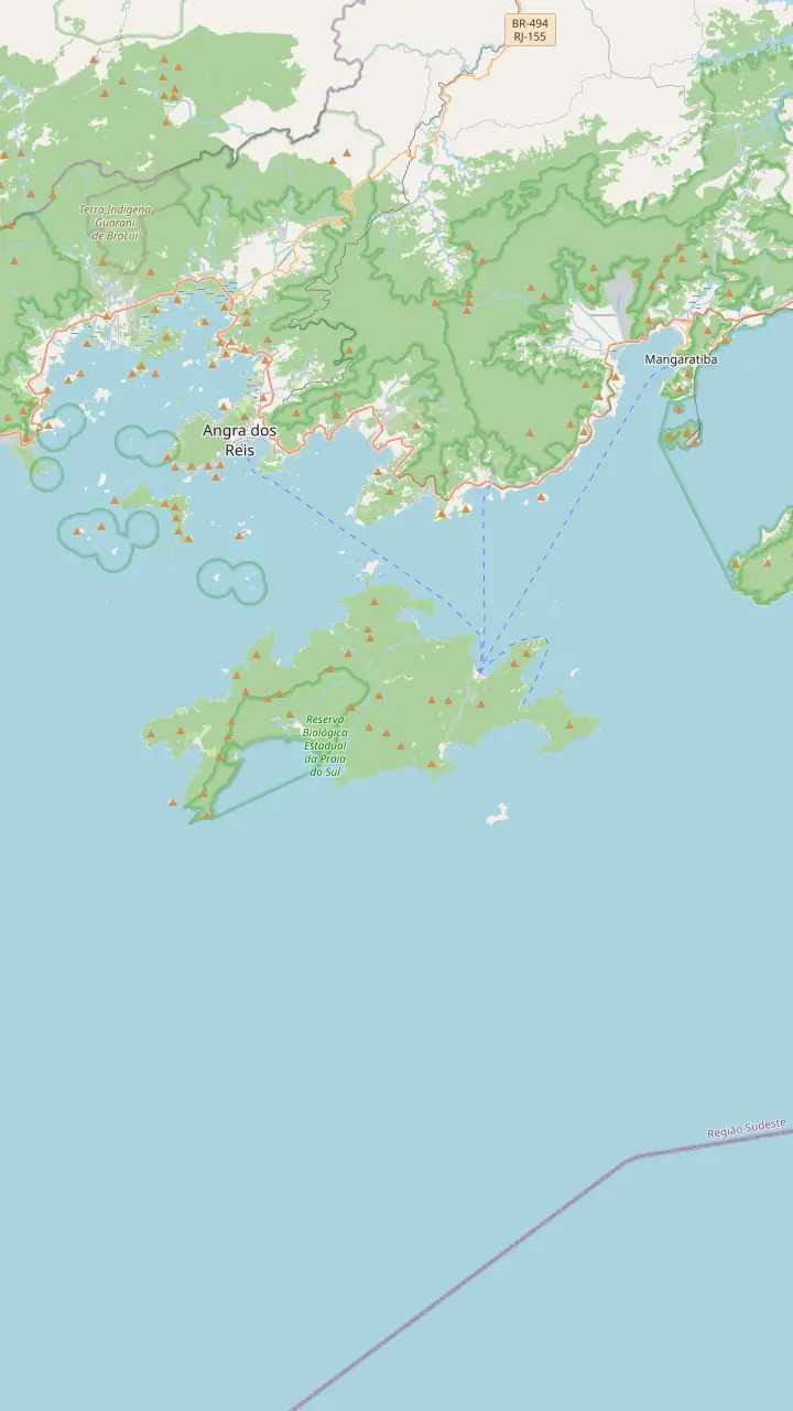
The main arrival point on Ilha Grande, with the most inns, restaurants, agencies and other services.
Google MapsThe main access point to Lopes Mendes, from where the walk is 1 km and about 20 minutes.
Google MapsAbout 3 km of white sand with rough water, shaded by almond trees.
Google MapsThe most visited waterfall in the state park, with a drop of about 15 m.
Google MapsThe village of the former Dois Rios prison, now used for research by the state university.
Google MapsThe second highest point on the island at 982 metres and its hardest trail.
Google MapsA lighthouse opened in 1900 at the far end of the island; visits must be authorised by the Navy.
Google MapsA beach on the south-east side of the island, drawn here to show how far the island runs beyond Dois Rios.
Google MapsA beach inside a sustainable development reserve, limited to 560 people per day.
Google MapsReached by boat, at the opposite end of the island from Lopes Mendes.
Google Maps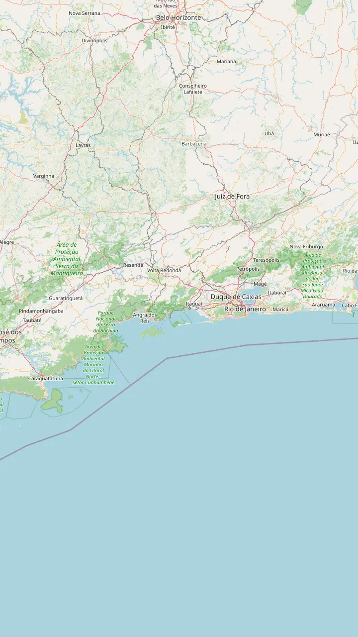
Rio's international airport, where the shared van transfers to Abraão start.
Google MapsThe city airport, listed with Galeão as a pickup point by a Rio to Abraão shuttle.
Google MapsMangaratiba lies about 85 km from the capital by the Rio-Santos highway, and the state park lists ferries from here to Abraão.
Google MapsA pier on the Mangaratiba shore, one of three departure points for the daily park ferries to Abraão.
Google MapsThe main pier in Angra dos Reis, where most boat tours leave and where the 35-minute speedboat crossing to Abraão starts.
Google MapsParaty bay has 50 beaches, some of them reached only by boat, and a shuttle links the town with Abraão.
Google MapsThe main arrival point on Ilha Grande, with the most inns, restaurants, agencies and other services.
Google Maps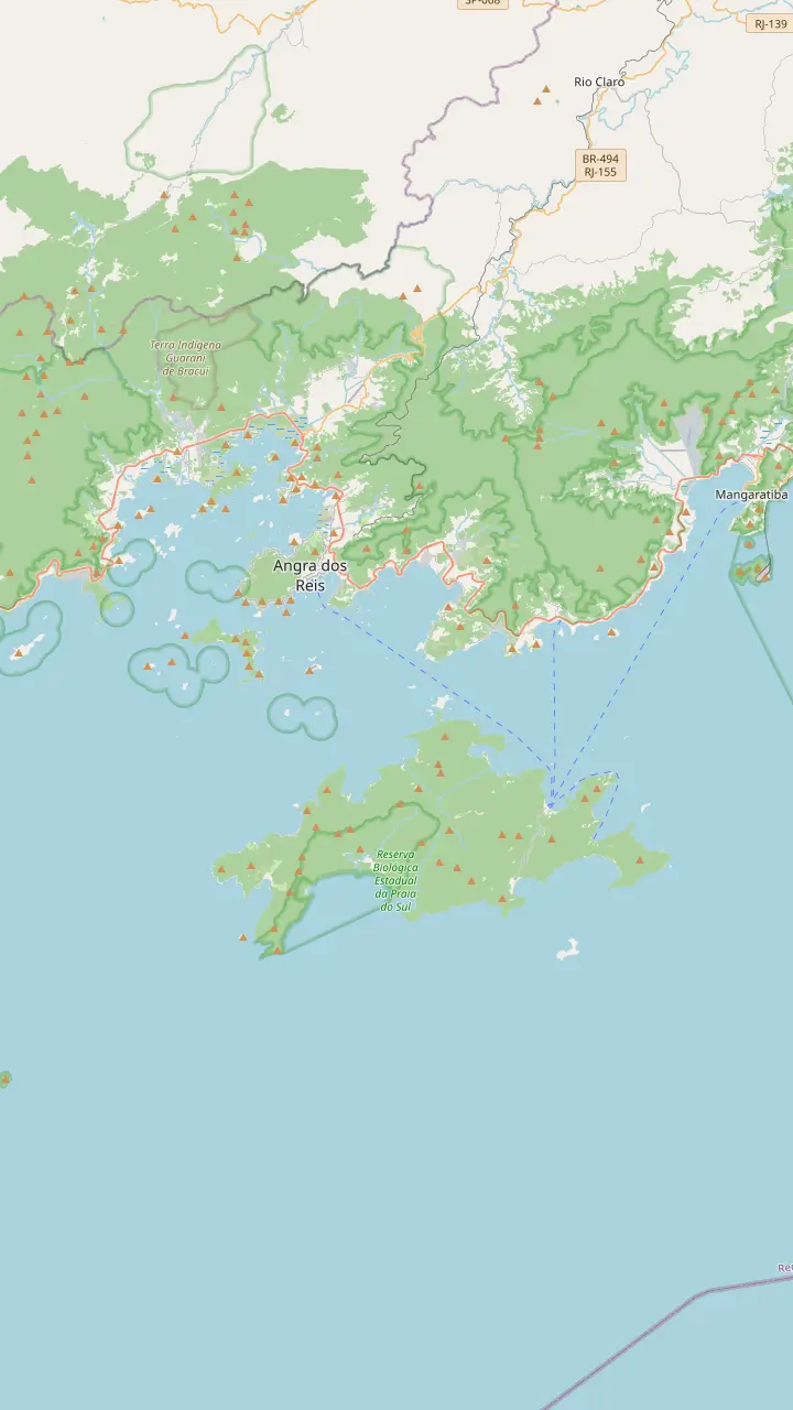
The main pier in Angra dos Reis, where most boat tours leave and where the 35-minute speedboat crossing to Abraão starts.
Google MapsA natural pool on Ilha dos Macacos, the point of Ilha Grande closest to the mainland.
Google MapsThe settlement of Ilha Grande began at Freguesia de Santana, which today has 50 residents.
Google MapsAn island of the Angra bay, drawn here to place the day's stops in the bay.
Google MapsA shallow, calm lagoon on the north-west coast near Araçatiba, tinted green.
Google MapsThe second most important tourism point on Ilha Grande, where boat trips and walks start.
Google MapsThe main arrival point on Ilha Grande, with the most inns, restaurants, agencies and other services.
Google MapsMap data: © OpenStreetMap contributors
Ilha Grande is the large island in the bay off Angra dos Reis, reached only by boat. This guide places its beaches and trails on a map and walks through the story of the island.
Editorial team, angradosreisboattrip.click · Updated November 12, 2026 · 8 mins to read
Essentials
The name Ilha Grande fits several places in Brazil. This one belongs to the municipality of Angra dos Reis on the Costa Verde, the coast of four municipalities, Angra dos Reis, Itaguaí, Mangaratiba and Paraty, in the state of Rio de Janeiro.6 The municipal portal counts 193 km2 of island territory out of 819 km2 for the whole municipality, which shows how much of Angra is water and islands.7
The island lies in the bay, a short boat ride from the mainland piers. Only boats get you there, says the state tourism portal, and the state park names Mangaratiba, Conceição de Jacareí and Angra dos Reis as the starting points of the daily ferries.2,8 By road, Angra lies 150 km from Rio and Mangaratiba about 85 km from the capital.9,10
On the map on this page, the island runs west to east, with the village of Abraão on the north-east shore and the Aventureiro and Provetá beaches at the far end. The municipal portal says the island covers 192 square kilometers, a large area for a place with no road link.1 Our page on getting to Ilha Grande lists every route from Rio, Angra and Paraty.
Beach by beach
| Beach | Water | How to get there | Note |
|---|---|---|---|
| Lopes Mendes | Rough, open sea20 | Walk 7.8 km or boat21 | About 3 km of sand19 |
| Meros | Calm and clear26 | Boat circuits | Snorkeling stop |
| Aventureiro | Can be rough27 | Boat, wristband first28 | Limit of 560 a day29 |
| Araçatiba | Green and calm30 | Boat trips start there31 | Snorkel and paddling30 |
| Caxadaço | Little boat traffic32 | Trail of 9 km33 | Only 15 m long32 |
| Provetá | By the west end34 | By boat34 | Beyond the biological reserve34 |
Notes follow the municipal and park pages; check each landing with your operator.
Vila do Abraão is where most visitors land. The municipal portal calls it the main arrival point on Ilha Grande, with the most inns, restaurants, agencies and other services, and the state park keeps its headquarters there.3,8 A tourist pier serves the village, and it is the landing point of the shared transfers from Rio.
From Abraão, the state park describes a chain of beaches along one route. The path via Palmas, Mangues and Pouso covers 5 km and takes 2h30 to 3 hours, with a viewpoint over the bay of Abraão on the climb, and Pouso is the main access to Lopes Mendes beach.17 From Pouso to Lopes Mendes the walk is 1 km, about 20 minutes, over ground that needs care in the rain.18
Lopes Mendes is the beach people travel for. The municipal portal says it has about 3 km of white, fine sand, rough water that surfers like and almond trees that shade the shore.19 It lies on the south, open-sea side of the island, where the water is wild, unlike the sheltered north side and the mainland.20 The direct walk from Abraão is 7.8 km and 4 hours, so the boat or the shorter walk from Pouso saves time.21
Trail lengths
Aventureiro is the beach with rules. It sits inside a sustainable development reserve and is limited to 560 people a day, and visitors must collect a wristband at the Santa Luzia station in Angra, open from 07h to 19h every day, after filling in a form and signing a commitment.29,28,35 The same page says it is hard to reach, and that when the sea is rough it is not advisable to sail past the Drago and Meros points.27
Parnaioca is one of the most isolated beaches of the island. The state park rates the trail from Dois Rios at 7.6 km and 5 to 6 hours, a heavy walk.24 Caxadaço is smaller than most of its neighbors: the municipal portal says it is only 15 meters long, ringed by preserved Atlantic Forest, between the beaches of Dois Rios and Lopes Mendes.32 The trail from Abraão is 9 km and about 4 hours, and the park advises against leaving Abraão after midday for it.33
Provetá lies at the other end of the island from Lopes Mendes and is reached by boat, beyond the Praia do Sul Biological Reserve.34 These far beaches are the reason boat circuits exist: the 8-hour speedboat circuit of the island lists stops at Caxadaço, Parnaioca, Aventureiro and Meros beaches. Many of them fall inside protected areas, so a landing is not guaranteed, and sea conditions decide what the boat does.
Pick your beach
Say what you want from a beach and see where to look.
If I want a long beach for a walk and surf
Lopes Mendes
About 3 km of white sand with rough water.19
If I want calm water for snorkeling
Meros or Araçatiba
Both have calm water, clear at Meros and green at Araçatiba.26,30
If I want a remote beach with rules
Aventureiro
The beach is limited to 560 people a day, with a wristband.29
If I want a tiny hidden bay
Caxadaço
The beach is only 15 meters long, ringed by forest.32
If I have just a few hours
The Abraão circuit
The gentle loop is 1.8 km and takes about 1h30.22
Beaches compared
South coast
Long sand with rough water
See the day trip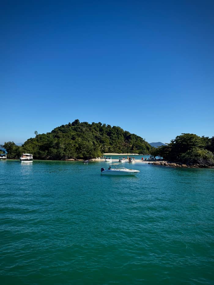
Reserve
A beach with a daily limit
See the day trip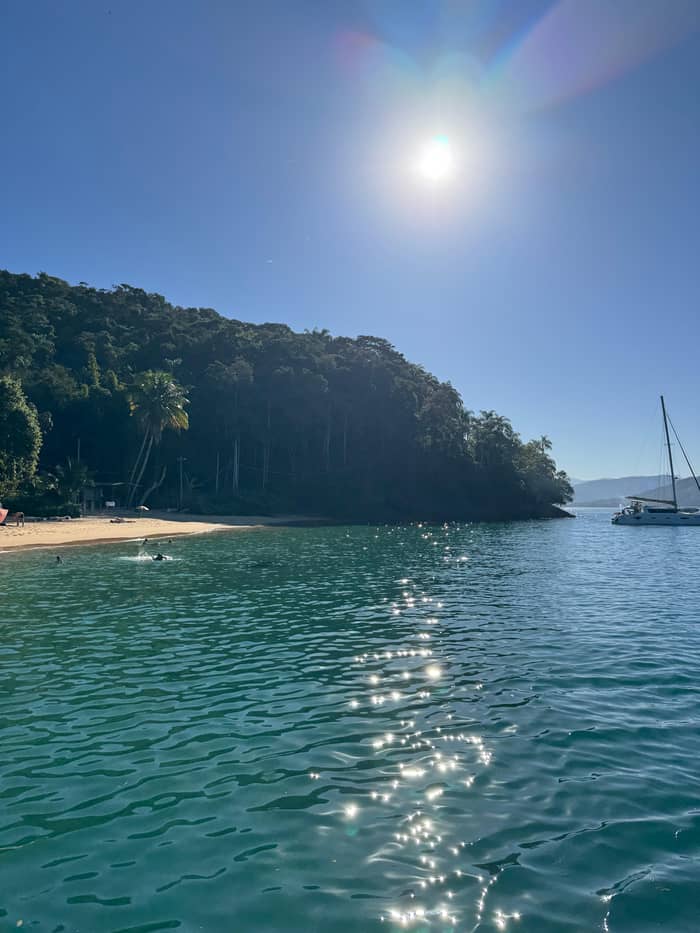
North-west
A calm bay for paddling
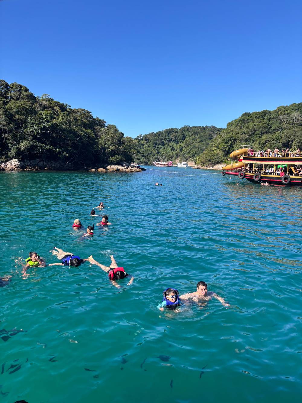
See the day tripThe north-west coast has calmer water. Araçatiba ranks as the second tourism hub of the island, a starting point for boat trips and walks, and its calm green water invites snorkel floating, stand-up paddling and canoeing.31,30 Lagoa Verde, a shallow, green-tinted lagoon, lies close to its inlet.39 That calm, typically green water is what gives the lagoon its nickname.
Meros beach is another calm, clear-water spot. The municipal portal says its calm, clear sea suits snorkeling to see marine life up close.26 Boat tours that circle the island list it, and one speedboat circuit gives it a stop for swimming and snorkeling. The sea at Meros can be a good place to ask a skipper for a quiet half hour in the water, away from the busier landings, and to check what the day's swell allows.
The north shore is also where the day trips stop. The day-trip stops lie along this north shore: the Blue Lagoon on Ilha dos Macacos, at the nearest point of the island to the mainland, and Freguesia de Santana, birthplace of the island settlement, home to 50 residents now.37,38 Our page on the lagoons and stops describes them one by one, with the tide, the corals and the time boats spend at each landing.
The story in order
Early peoples
The island was first inhabited about 3,000 years ago.11
Pirate era
Visited by pirates until the 18th century; the navy patrolled from 1850.12
1886 to 1913
A quarantine hospital for immigrants at Vila do Abraão.13
1903 to 1994
Now used for research by the state university.14
1970s and 1991
A state park, a biological reserve and a UNESCO biosphere listing.15,16
2019
Listed with Paraty as a mixed cultural and natural site.5
Most of the island is protected. The state park, managed by the state environment institute, keeps its headquarters in Vila do Abraão, with an office open on weekdays from 8 to 17h.8,47 More than 90% of the park is dense Atlantic Forest, crossed by over 80 km of trails.48,4 The paths link beaches, waterfalls, viewpoints and old ruins, so a walk on the island is also a lesson in its history.
The wildlife is part of the draw. The brown howler monkey, a critically endangered species, is the symbol of the park; the wider World Heritage area also records the jaguar and the muriqui among its rare mammals, and holds 57% of the endemic birds of the Atlantic Forest hotspot.49,50,51 Visitors are asked to watch animals from a distance and not to feed them.44
The park also supplies water. The state pages say it is the producer of the water that supplies all the villages and settlements of the island.52 The rules are short: keep to the trails, light no fires, carry first aid materials and leave pets at home.44,53,46 Following them keeps the paths open and the animals wild.
Video
Axperience on YouTube · Tap play to load the video; not before.
On that open-sea face the waters are wild, unlike the north side and the mainland itself, whose beaches are protected and therefore calmer.
Island checklist
The island has been lived on for a long time. The state park says it was first inhabited about 3,000 years ago by the Sambaqui and Pedra Polida peoples, and later by the Tupinambá.11 The municipal portal adds that the Tamoio and Tupinambá peoples named it Ipaum Guaçu, which means Ilha Grande, and that they opened the trails still used today.54
Pirates and smugglers followed. The municipal portal says that until the 18th century the island interested few people and was visited mainly by Dutch, French and English pirates, and that the Brazilian navy began to patrol its waters in 1850.12 In the 18th century Freguesia de Santana was the economic center, with coffee, vegetables, cereals and sugar mills.55
The prisons come next. Quarantine came first: the Lazareto for immigrants was built between 1884 and 1886 and operated until 1913, and around the 1940s its building became the Candido Mendes penal colony, shut in 1954 and torn down in 1961.56,13,57 A second prison at Dois Rios operated from 1903 to 1994, and the writers Graciliano Ramos and Origenes Lessa spent time there and wrote about it.14,58
The modern protections come in layers. Protection arrived in layers: a state park and the Praia do Sul Biological Reserve in the 1970s, then UNESCO biosphere recognition in 1991.15,16 July 2019 brought the World Heritage listing shared with Paraty, Brazil first property to be both cultural and natural.5,59 UNESCO bases the listing on both the cultural landscape and the biodiversity of the Atlantic Forest.60
UNESCO's own record describes a serial property of six component parts, four of them protected areas, among them the Ilha Grande State Park and the Praia do Sul Biological Reserve, with the Paraty Historic Centre and the Morro da Vila Velha.61 The two protected areas on the island cover most of the largest island in the bay, and they also hold cultural assets of indigenous people and of European settlers from the 16th century onward.62
Visitors can still see the relics of this past. Relics remain for visitors: the old aqueduct, the Lazareto ruins, the Castelhanos lighthouse, the Mansão do Morcego and the Santana church, with the 1900 lighthouse open to visits only when the Navy authorizes them.63,42,43 The Abraão circuit passes the aqueduct and the Lazareto ruins on a gentle loop of 1.8 km.22
Start from the village and think in half days. The Abraão circuit takes 1h30, the Feiticeira waterfall is a walk of about 1h30, and the road to Dois Rios and the former prison is 9 km and 3 hours.22,40,25 Choose one for the afternoon you land and a bigger walk for the next morning, and leave the long trails for a day with no rain.
For the beaches you cannot walk to, book a boat. A boat day from Rio starts from $75 and visits the lagoons and Freguesia de Santana, while the speedboat circuit reaches the far beaches. Ask the operator about landings, because sea conditions can stop a boat at a safe distance from the shore.
Add the history if you like it. The ruins of the Lazareto and the prison at Dois Rios are on the walking routes, and the park advises hiring a conductor for the harder trails.45 Check the rules of each protected area before you go, and read the weather page of this guide before you choose a date, since rain changes both the trails and the sea.
FAQ
The Angra dos Reis portal counts 106 beaches, waterfalls and mountains on an island of 192 square kilometers.1
The portal says it has about 3 km of white, fine sand and rough water that surfers like.19
A prison at Dois Rios operated from 1903 to 1994 and is now used for research by the state university.14
It received immigrants suspected of disease and worked from 1886 to 1913 at Vila do Abraão.13
Sources
Planning a day on the water at Angra? Ask a real person here.